About Us
Contact Us
Governance
Media Resources
Connect
Español
Back to Redcross.org
Give Blood
»
Volunteer
»
Shop Our Store
»
Map, Weather & Hazard Catalogs
State Level Maps - FLORIDA
Red Cross Catalogs & Resources:
Home
Map Catalog
Weather & Hazard Center
Tropical Hazard Center
National Level Map Catalog
Map Services Catalog
Weather Calulators
RC View Enterprise Mapping Portal
(Restricted access)
Org Online Mapping Portal
(ArcGIS Online Org Map Center)
Access FOCIS
(Restricted access)
Evacuation Route Maps
Storm Surge Maps
Storm Surge Atlases
Flood Hazard Maps
North Evacuation Routes
South Evacuation Routes
Alachua County Evacuation
Baker County Evacuation
Bay County Evacuation
Bradford County Evacuation
Brevard County Evacuation
Broward County Evacuation
Calhoun County Evacuation
Charlotte Co. Evacuation
Citrus County Evacuation
Clay County Evacuation
Collier County Evacuation
Columbia County Evacuation
DeSoto County Evacuation
Dixie County Evacuation
Duval County Evacuation
Escambia Co. Evacuation
Flagler County Evacuation
Franklin County Evacuation
Gadsden County Evacuation
Gilchrist County Evacuation
Glades County Evacuation
Gulf County Evacuation
Hamilton County Evacuation
Hardee County Evacuation
Hendry County Evacuation
Hernando Co. Evacuation
Highlands Co. Evacuation
Hillsborough Co. Evacuation
Holmes County Evacuation
Indian River Co. Evacuation
Jackson County Evacuation
Jefferson Co. Evacuation
Lafayette Co. Evacuation
Lake County Evacuation
Lee County Evacuation
Leon County Evacuation
Levy County Evacuation
Liberty County Evacuation
Madison County Evacuation
Manatee County Evacuation
Marion County Evacuation
Martin County Evacuation
Miami Dade Co. Evacuation
Monroe County Evacuation
Nassau County Evacuation
Okaloosa Co. Evacuation
Okeechobee Co. Evacuation
Orange County Evacuation
Osceola County Evacuation
Palm Beach Co. Evacuation
Pasco County Evacuation
Pinallas County Evacuation
Polk County Evacuation
Putnam County Evacuation
Santa Rosa Co. Evacuation
Sarasota Co. Evacuation
Seminole County Evacuation
St. Johns Co. Evacuation
St. Lucie Co. Evacuation
Sumter County Evacuation
Suwanee Co. Evacuation
Taylor County Evacuation
Union County Evacuation
Volusia County Evacuation
Wakulla County Evacuation
Walton County Evacuation
Washington Co. Evacuation
Bay County Surge
Brevard County Surge
Broward County Surge
Calhoun County Surge
Charlotte County Surge
Citrus County Surge
Clay County Surge
Collier County Surge
DeSoto County Surge
Dixie County Surge
Duval County Surge
Escambia County Surge
Flagler County Surge
Franklin County Surge
Gilchrist County Surge
Glades County Surge
Gulf County Surge
Hendry County Surge
Hernando County Surge
Highlands County Surge
Hillsborough County Surge
IndianRiver County Surge
Jefferson County Surge
Lee County Surge
Leon County Surge
Levy County Surge
Manatee County Surge
Martin County Surge
Miami Dade County Surge
Monroe County Surge
Nassau County Surge
Okaloosa County Surge
Okeechobee County Surge
Palm Beach County Surge
Pasco County Surge
Pinallas County Surge
Putnam County Surge
Santa Rosa County Surge
Sarasota County Surge
St. Johns County Surge
St. Lucie County Surge
Taylor County Surge
Volusia County Surge
Wakulla County Surge
Walton County Surge
Washington County Surge
Please Note: some of these files are very large and may take some time to download.
Bay County Surge Zone Atlas
Brevard County Surge Zone Atlas
Broward County Surge Zone Atlas
Charlotte County Surge Zone Atlas
Clay County Surge Zone Atlas
Collier County Surge Zone Atlas
DeSoto County Surge Zone Atlas
Dixie County Surge Zone Atlas
Duval County Surge Zone Atlas
Escambia County Surge Zone Atlas
Flagler County Surge Zone Atlas
Gilchrist County Surge Zone Atlas
Glades County Surge Zone Atlas
Gulf County Surge Zone Atlas
Hendry County Surge Zone Atlas
Hernando County Surge Zone Atlas
Highlands County Surge Zone Atlas
Hillsborough County Surge Zone Atlas
IndianRiver County Surge Zone Atlas
Lafayette County Surge Zone Atlas
Lee County Surge Zone Atlas
Manatee County Surge Zone Atlas
Martin County Surge Zone Atlas
Miami Dade County Surge Zone Atlas
Monroe County Surge Zone Atlas
Nassau County Surge Zone Atlas
Okaloosa County Surge Zone Atlas
Okeechobee County Surge Zone Atlas
Palm Beach County Surge Zone Atlas
Pasco County Surge Zone Atlas
Pinallas County Surge Zone Atlas
Putnam County Surge Zone Atlas
Santa Rosa County Surge Zone Atlas
Sarasota County Surge Zone Atlas
St. Johns County Surge Zone Atlas
St. Lucie County Surge Zone Atlas
Taylor County Surge Zone Atlas
Volusia County Surge Zone Atlas
Walton County Surge Zone Atlas
Washington County Surge Zone Atlas
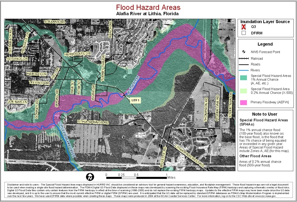
Alafia River at Lithia
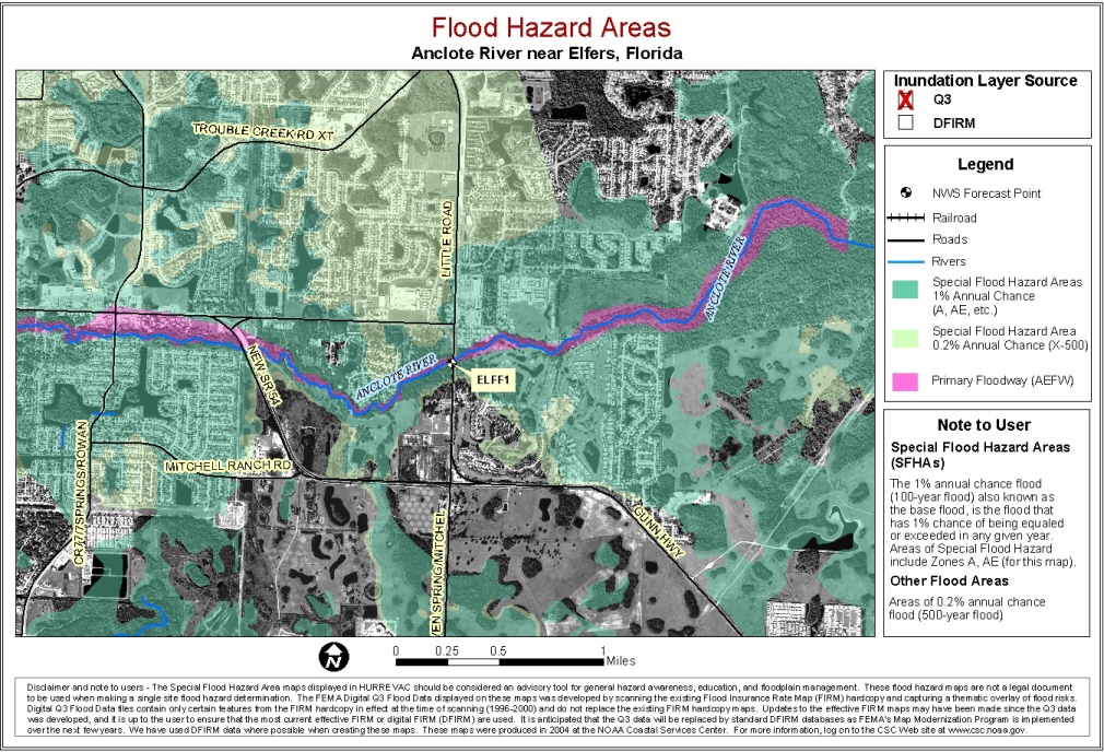
Anclote River near Elfers
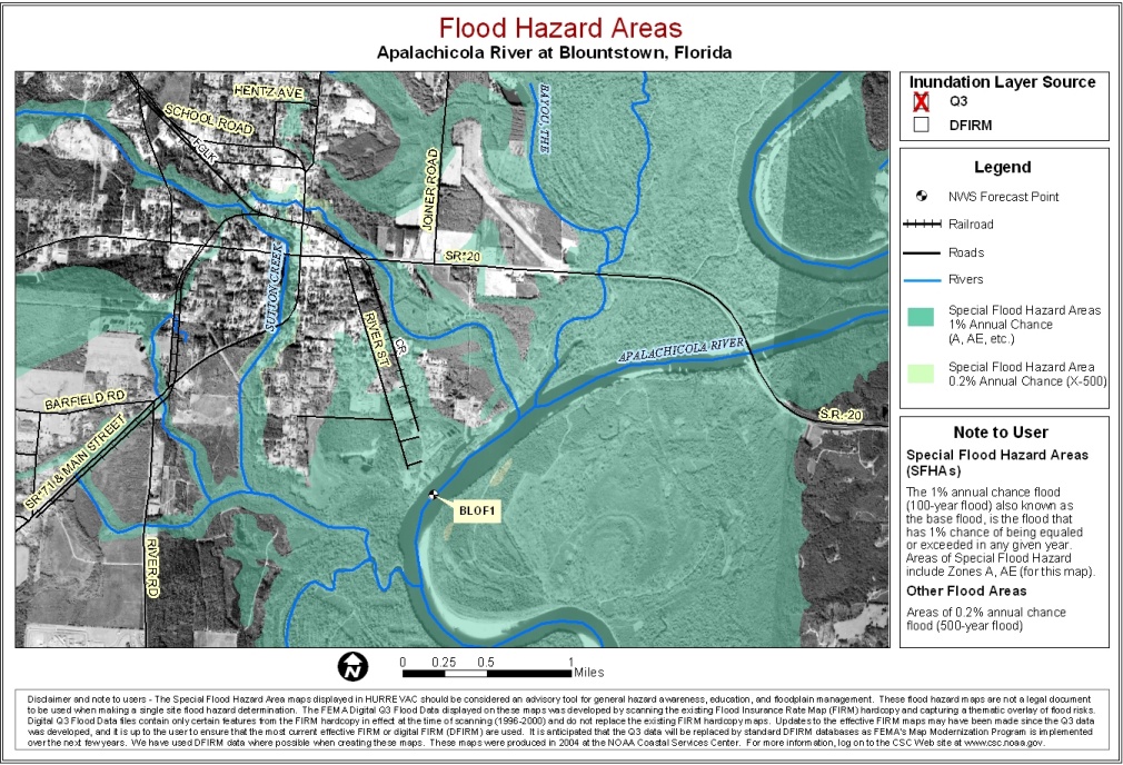
Apalachicola River at Blountstown
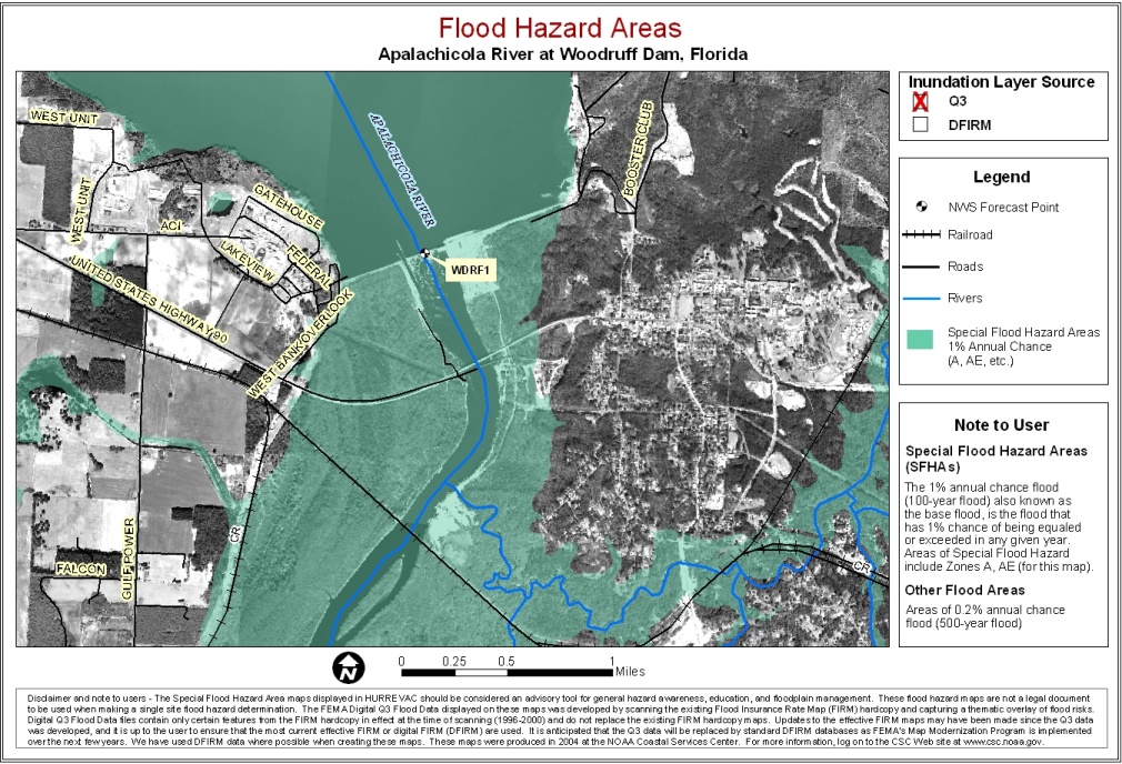
Apalachicola River at Woodruff Dam
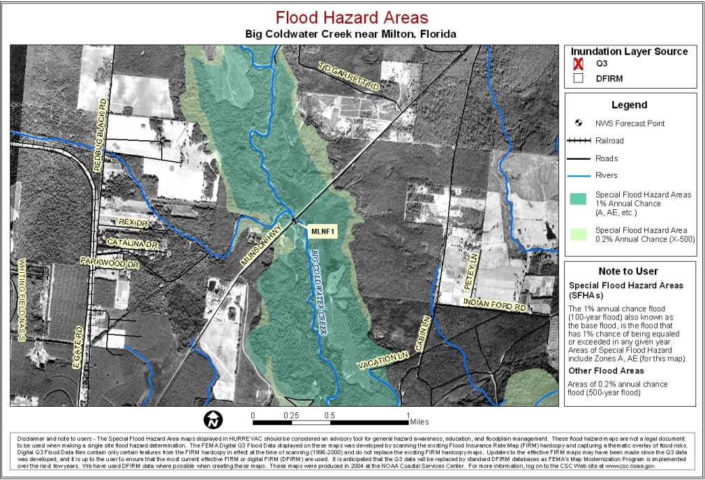
Big Coldwater Creek near Milton
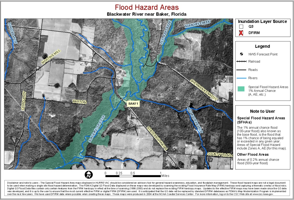
Blackwater River near Baker
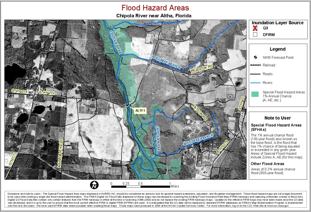
Chipola River near Altha
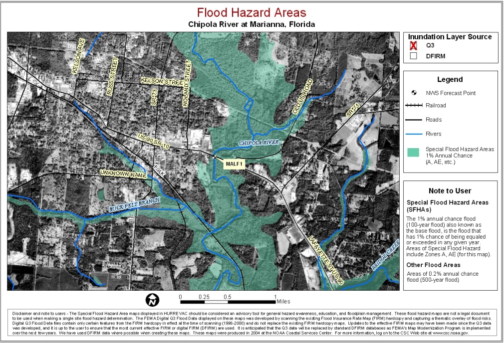
Chipola River at Marianna
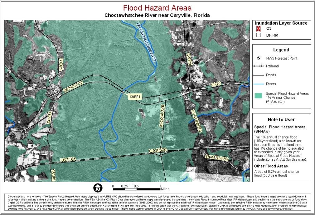
Choctawhatchee River near Caryville
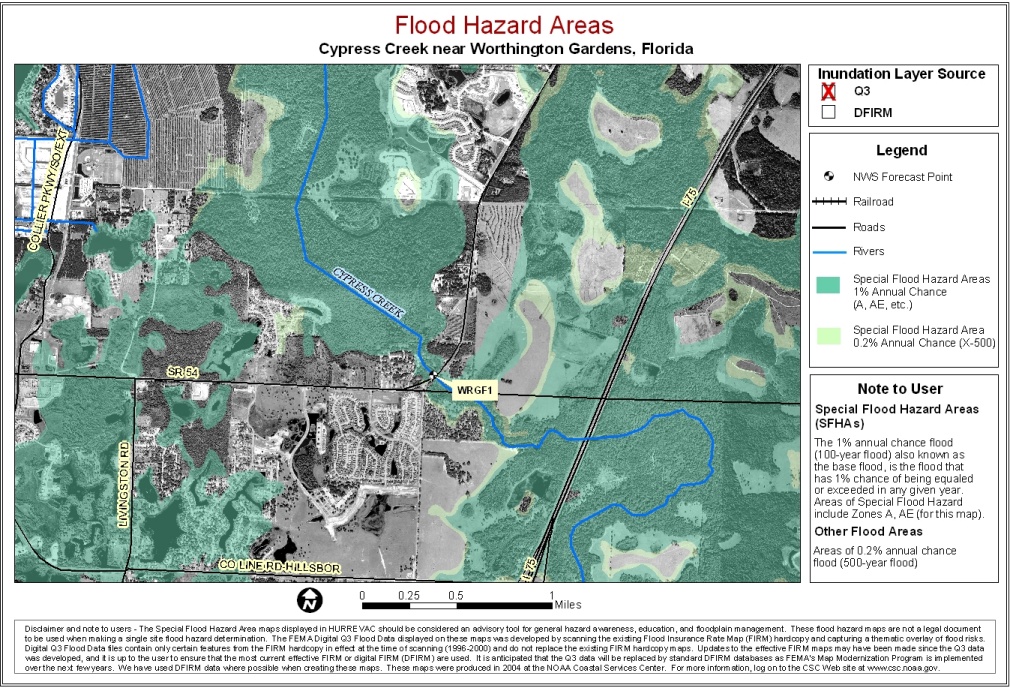
Cypress Creek near Worthington Gardens
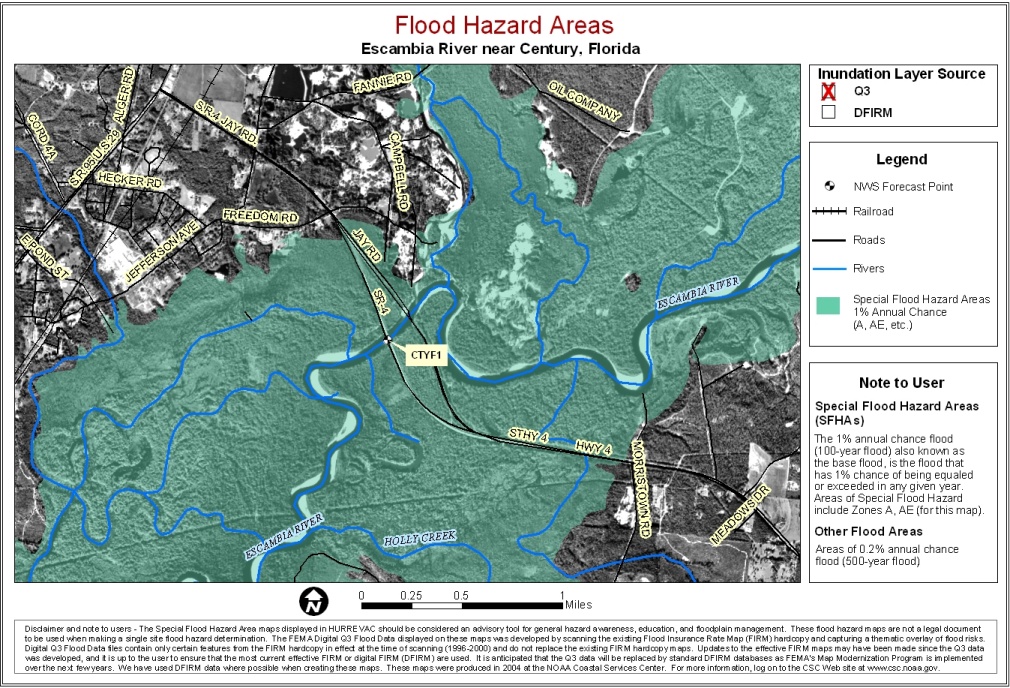
Escambia River near Century
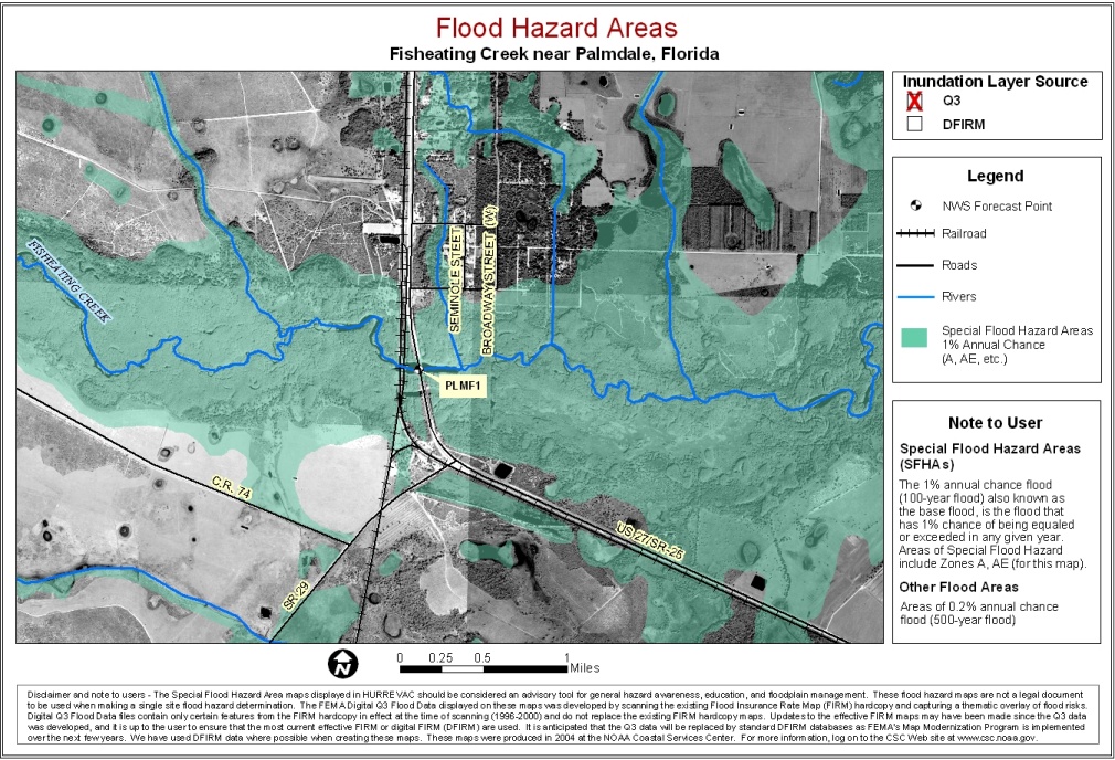
Fisheating Creek near Palmdale
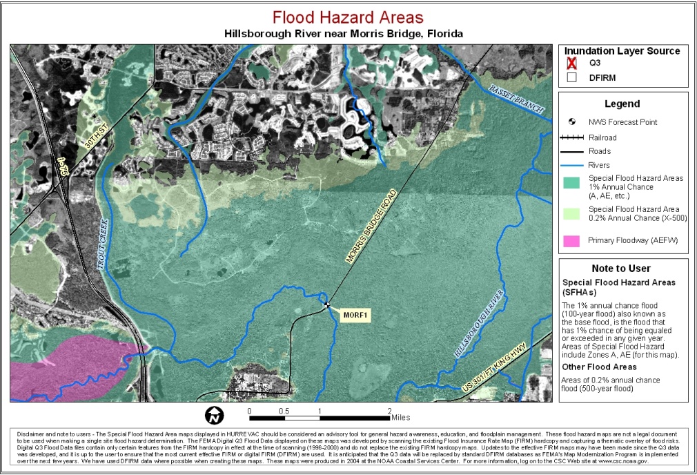
Hillsborough River near Morris Bridge
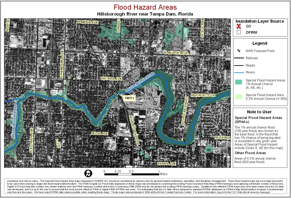
Hillsborough River near Tampa Dam
Hillsborough River near Zephyrhills
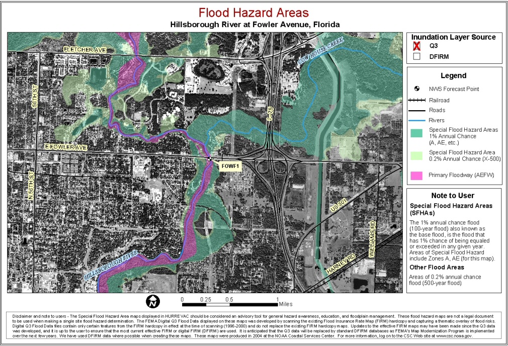
Hillsborough River at Fowler Ave.
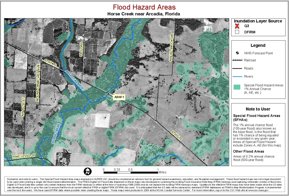
Horse Creek near Arcadia
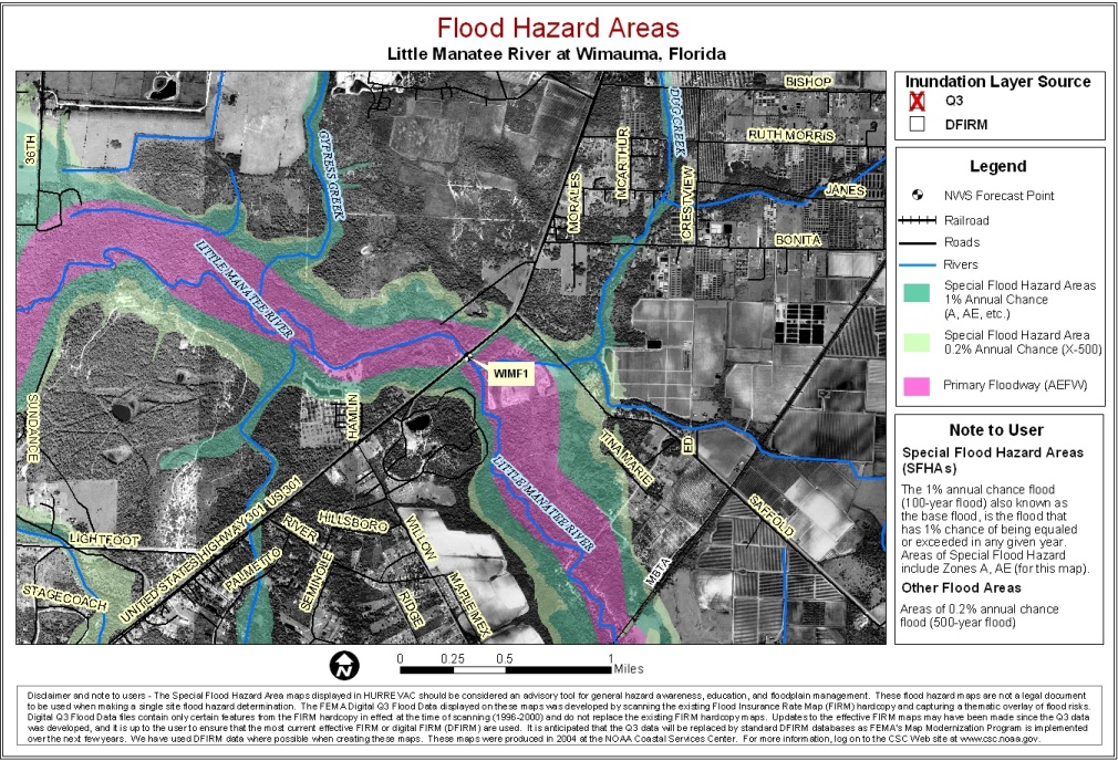
Little Manatee River at Wimauma
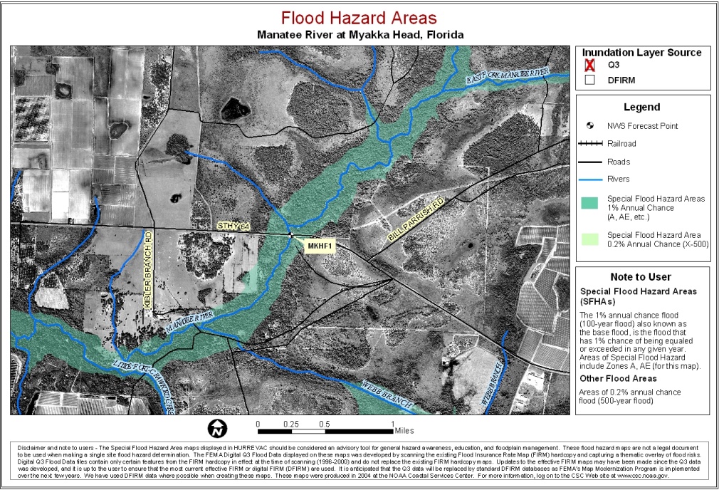
Manatee River at Myakka Head
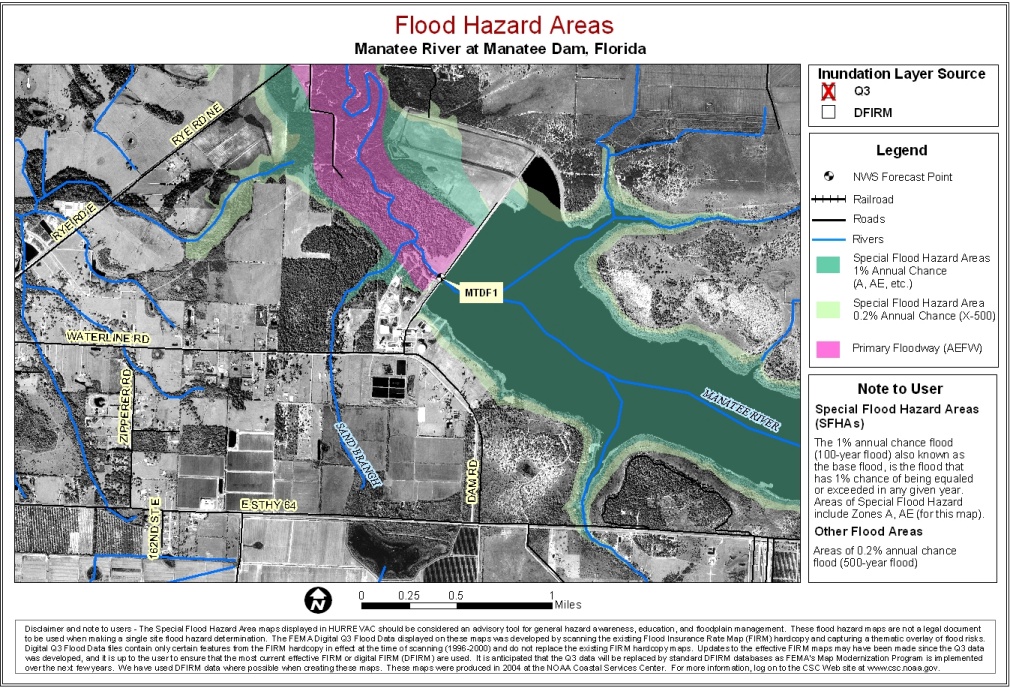
Manatee River at Manatee Dam
Manatee River at Rye Bridge
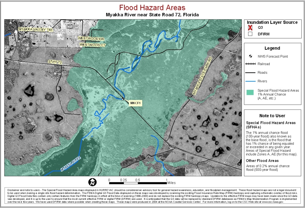
Myakka River near St Rd 72
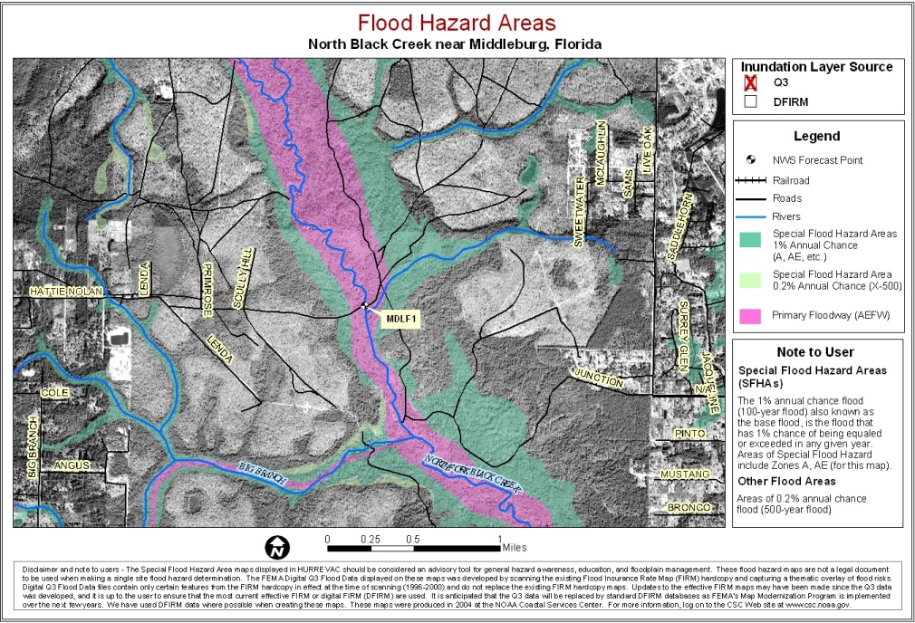
North Black River near Middleburg
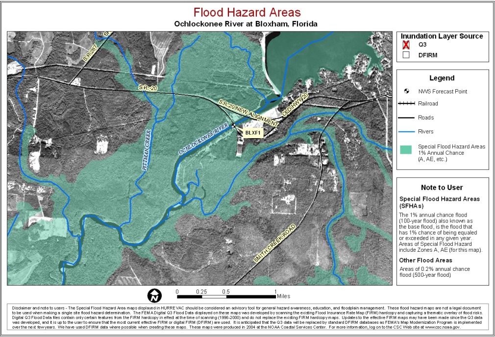
Ochlockonee River at Bloxham
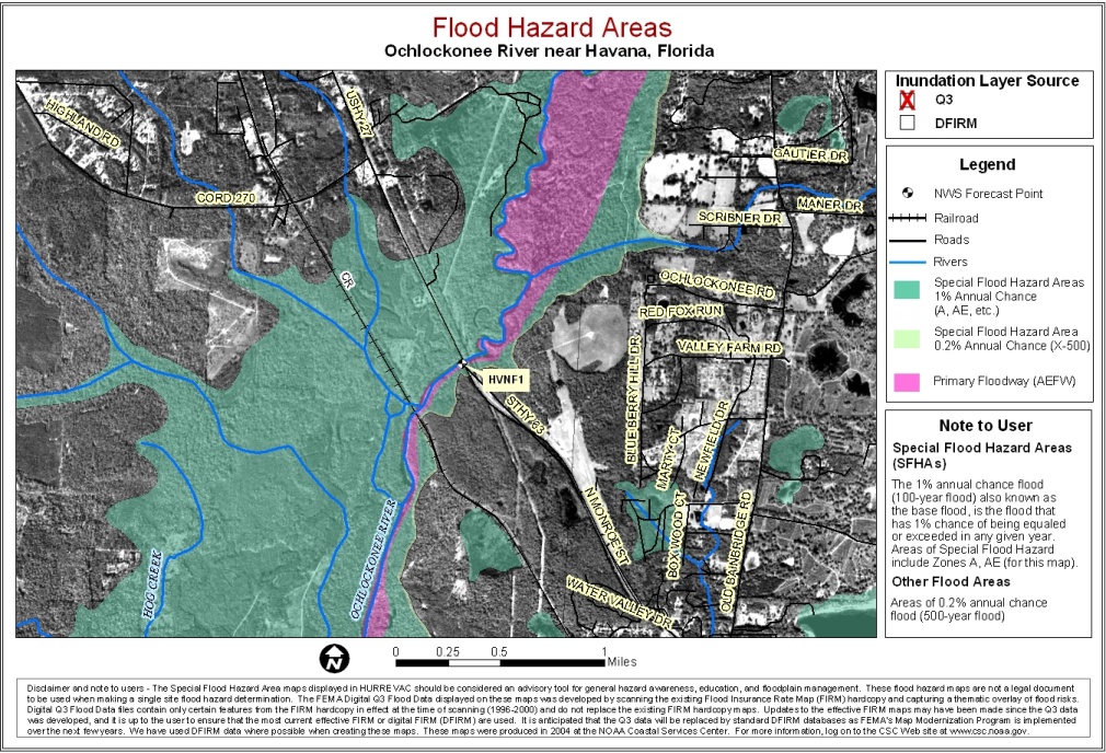
Ochlockonee River near Havana
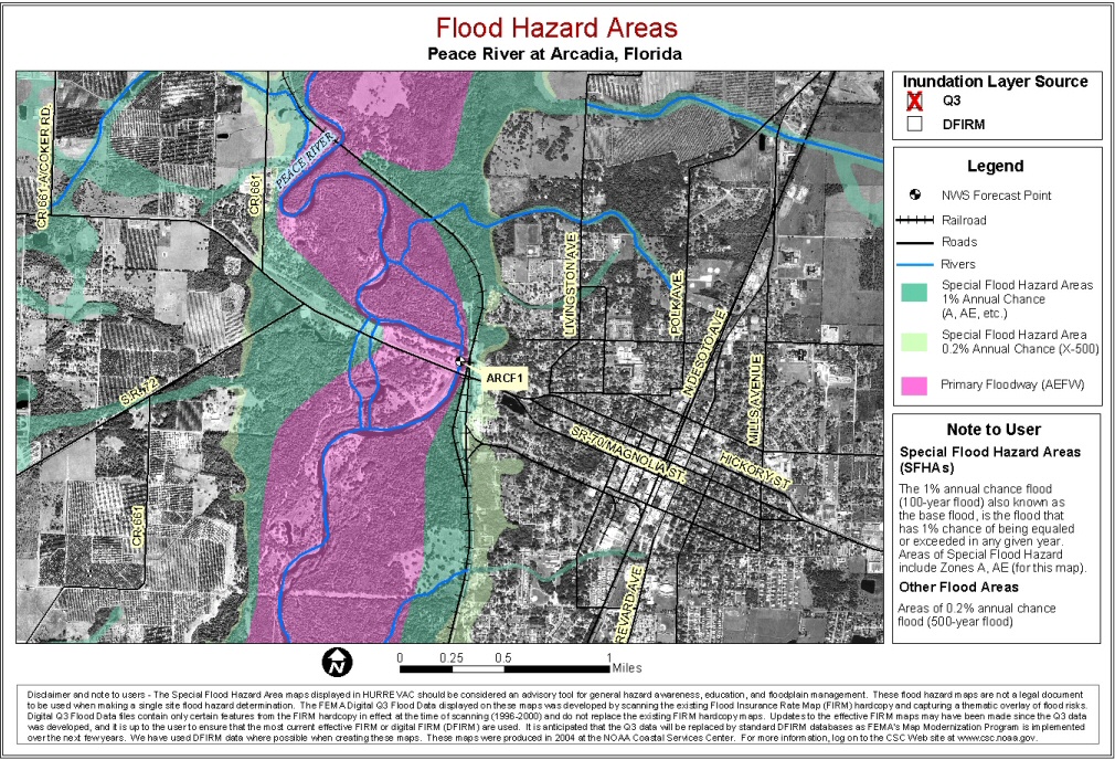
Peace River at Arcadia
Peace River near Bartow
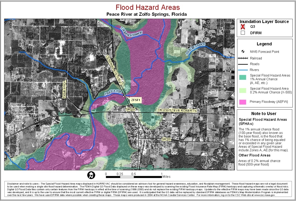
Peace River at Zolfo Springs
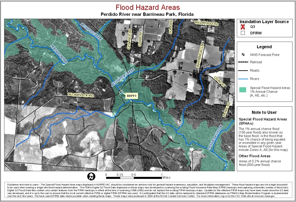
Perdido River near Barrineau Park
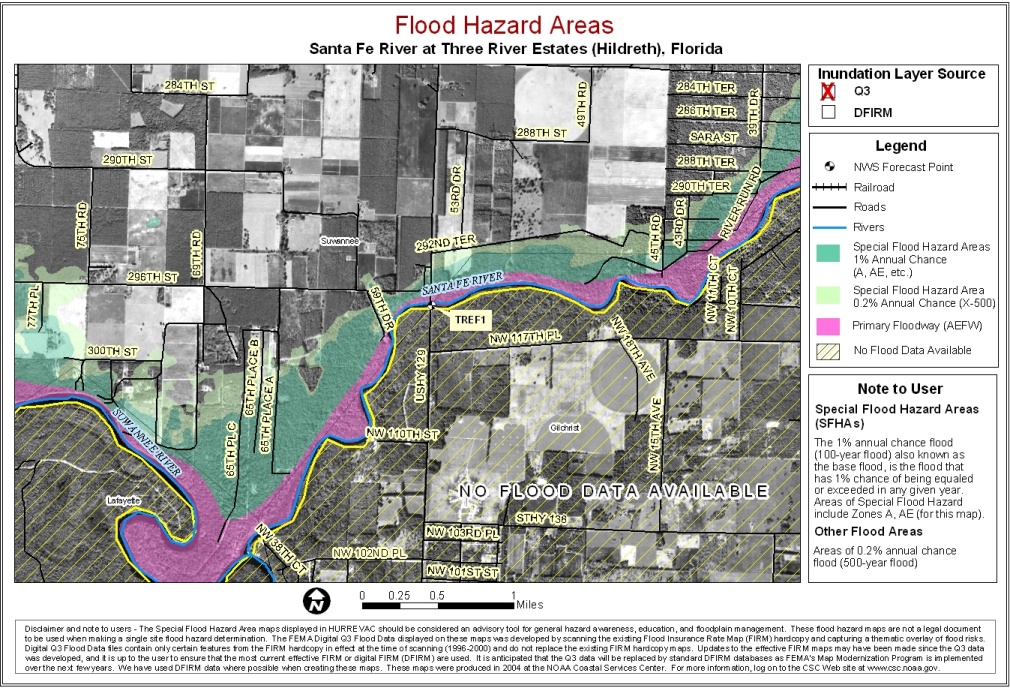
Santa Fe River at Hildreth
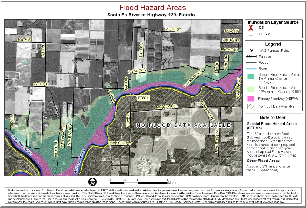
Santa Fe River at Hwy 129
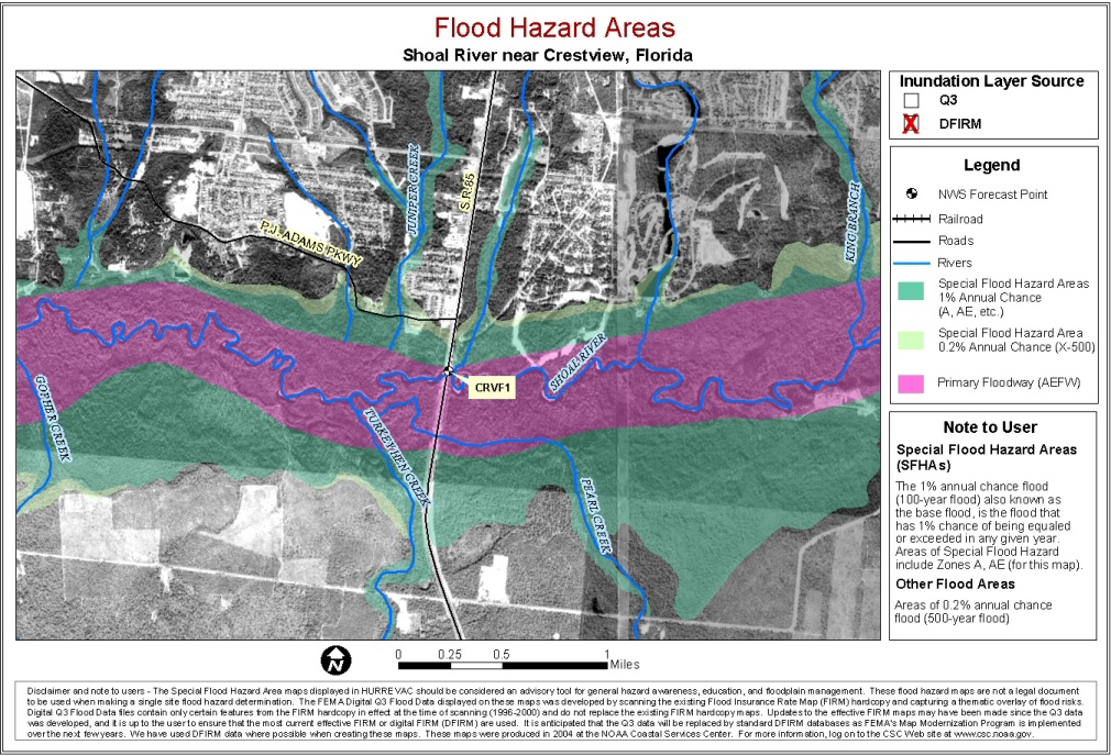
Shoal River near Crestview
St. John's near Deland
St. John's River above Lake Harney
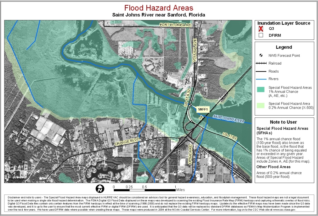
St. John's River near Sanford
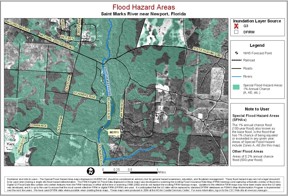
St. Marks River near Newport
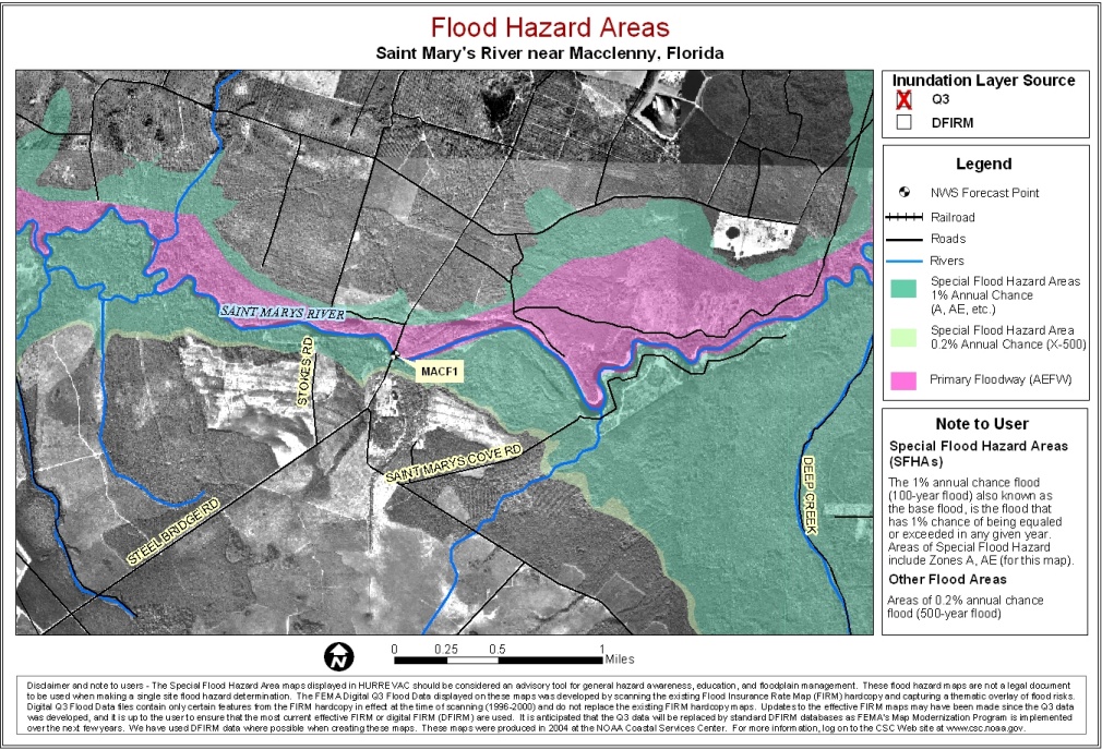
St. Mary's River near MacClenny
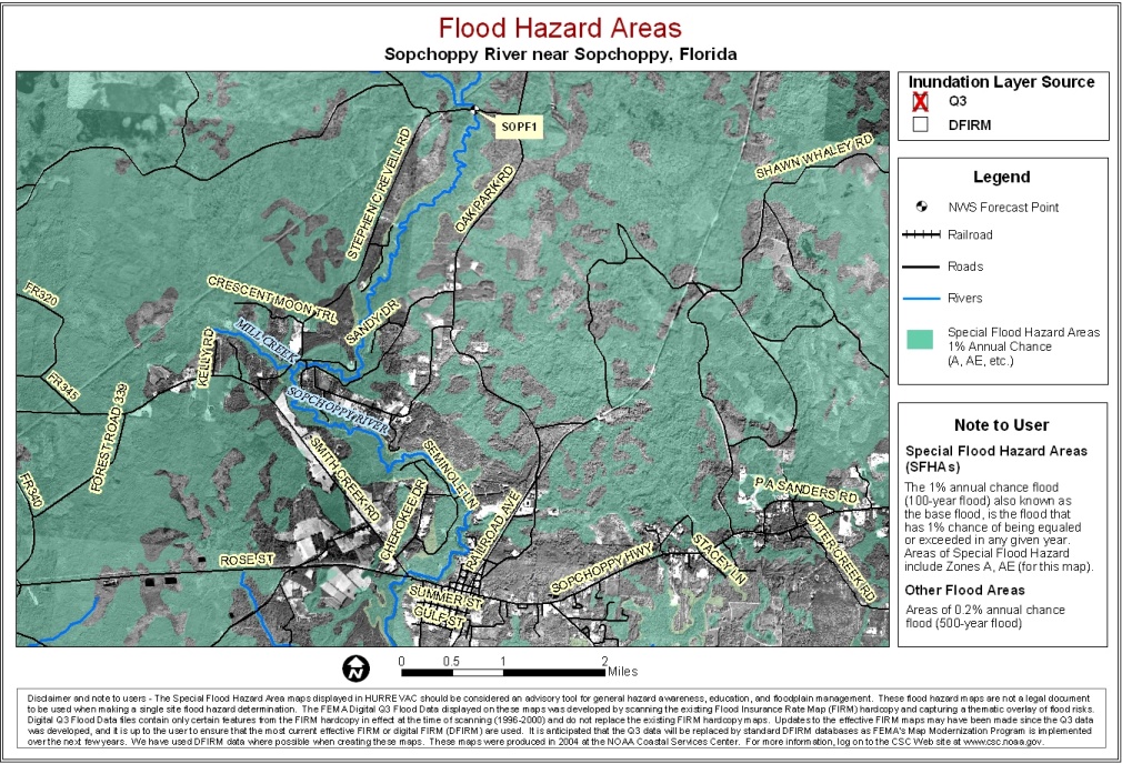
Sopchoppy River near Sopchoppy
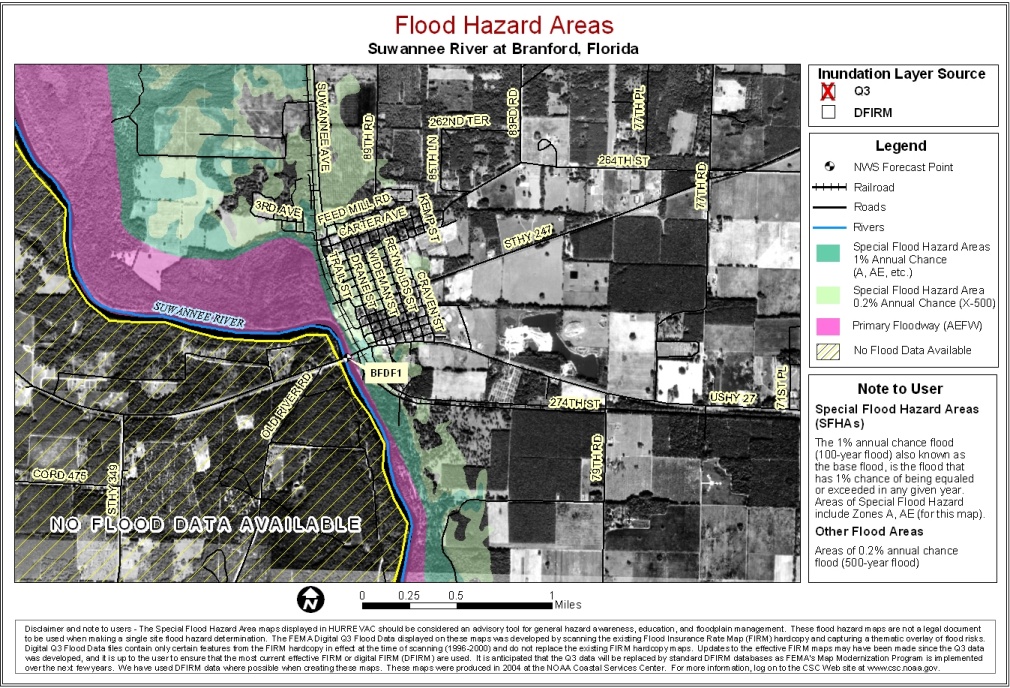
Suwannee River at Branford
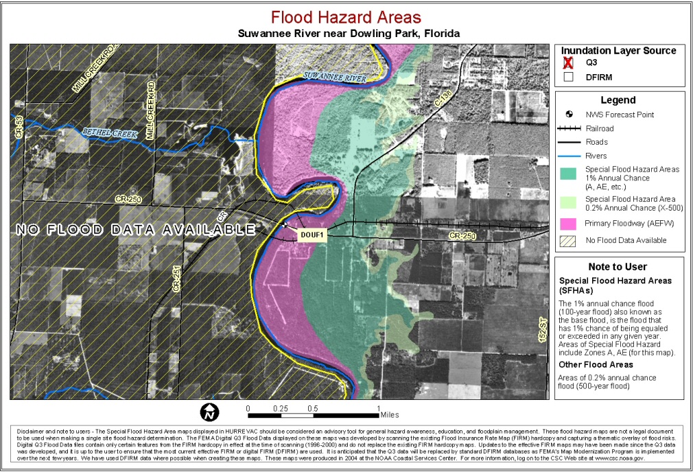
Suwannee River near Dowling Park
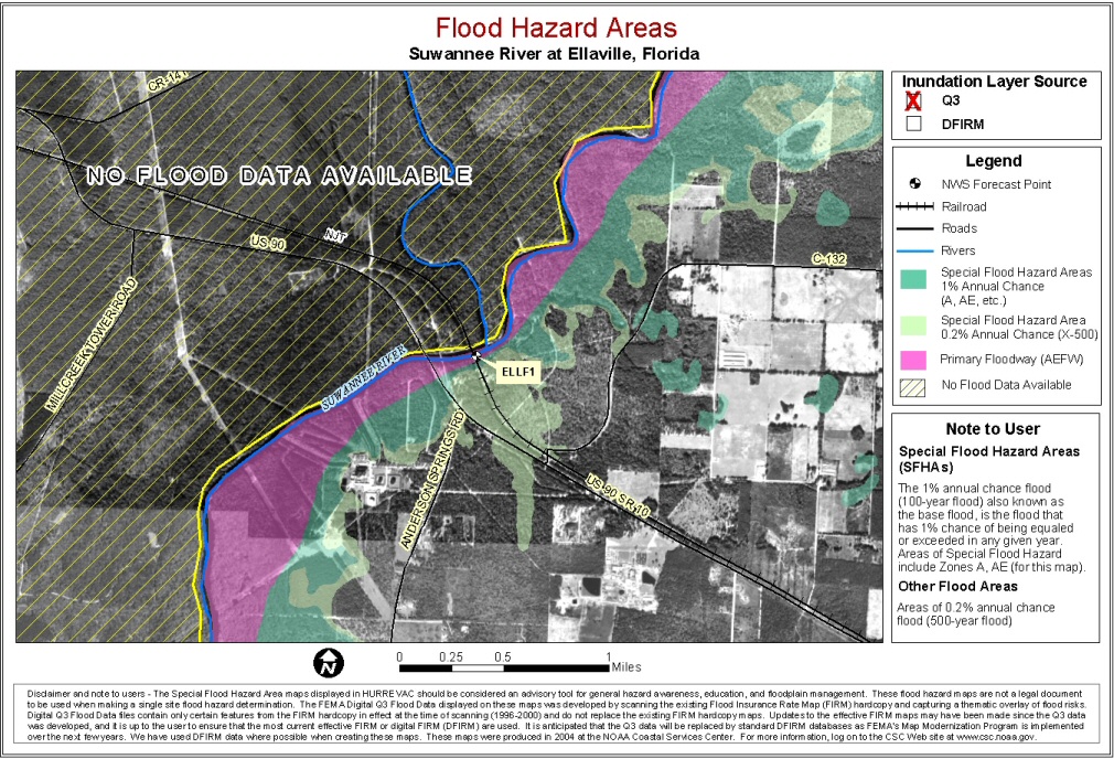
Suwannee River near Ellaville
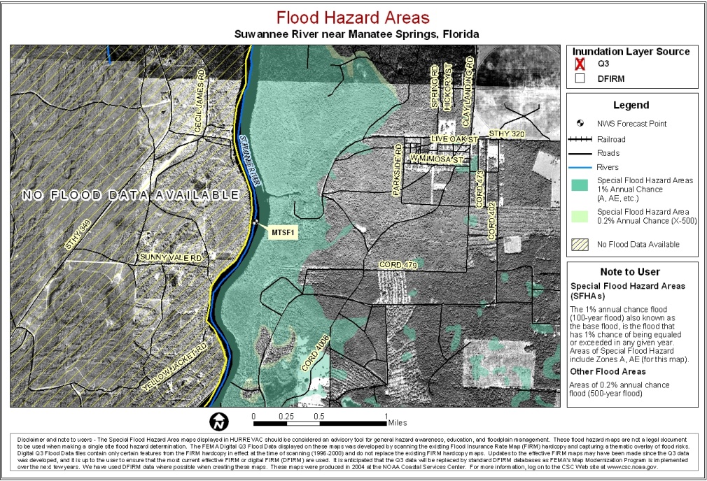
Suwannee River near Manatee Springs
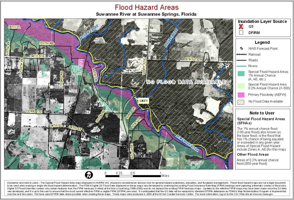
Suwannee River at Suwannee Springs
Suwannee River near Wilcox
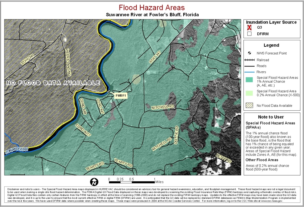
Suwannee River at Fowler's Bluff
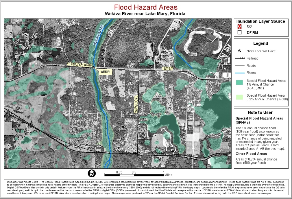
Wekiva River near Lake Mary
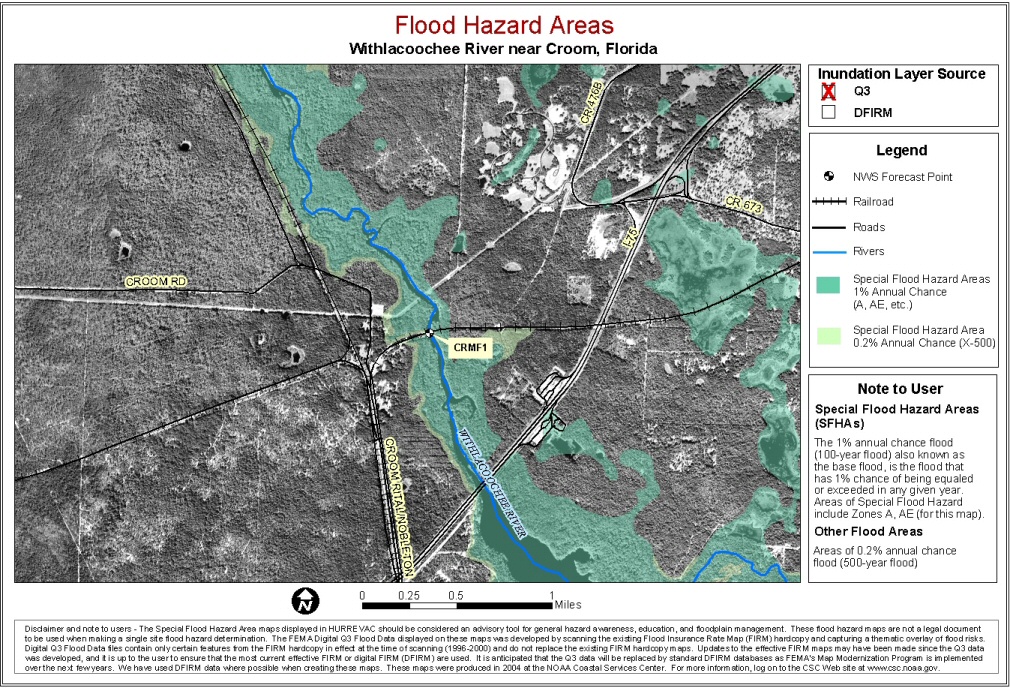
Withlacoochee River near Croom
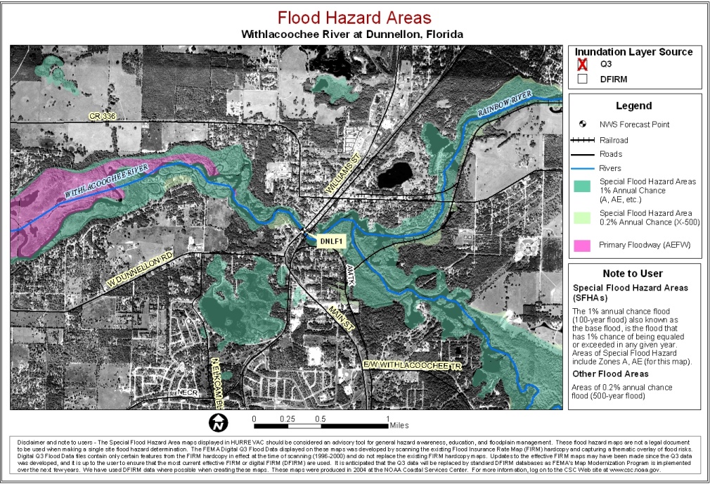
Withlacoochee River at Dunnellon
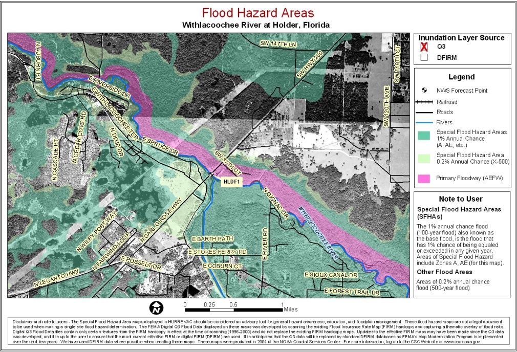
Withlacoochee River at Holder
Withlacoochee River at Trilby
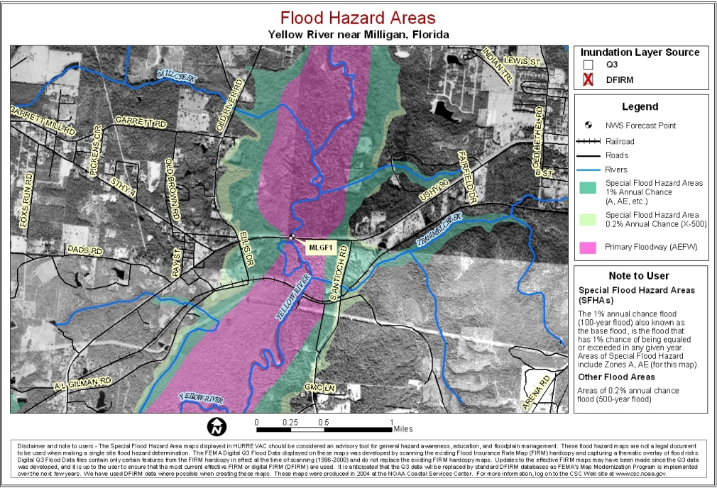
Yellow River near Milligan